October 12, 1996
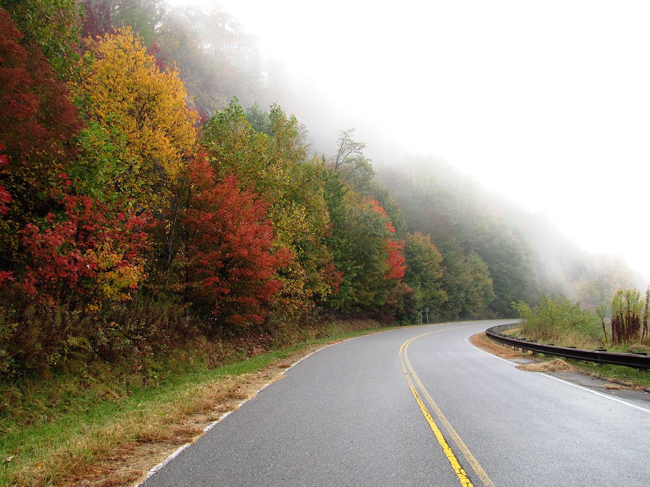
Work was officially completed on a road coursing through a picturesque region of the southeastern United States. The Cherohala Skyway is a 43-mile (69-kilometer) route between the towns of Tellico Plains in Tennessee and Robbinsville in North Carolina. The name for this skyway is a portmanteau of Cherokee and Natahala, referring to two national forests that are located along the route and managed by the U.S. Forest Service (USFS) of the U.S. Department of Agriculture. The Cherokee National Forest lies within both Tennessee and North Carolina, while the Nantahala National Forest is located only in the latter of those states.
The Cherohala Skyway provides vehicular access to not only a large number of outlooks and vistas but also quite a few recreational areas within the Unicoi Mountains (a mountain range along the Tennessee-North Carolina border). The Tennessee-based portion of the Cherohala Skyway follows Tennessee State Route 165 for approximately 25 miles (40 kilometers) between Tellico Plains and the state line at Stratton Gap; North Carolina’s share of this skyway follows North Carolina Highway 143 for about 18 miles (29 kilometers) between Stratton Gap and Robbinsville.
The Cherohala Skyway’s highest elevation is more than 5,400 feet (1,600 meters) above mean sea level near Haw Knob, one of the Unicoi Mountains. This skyway’s lowest point is about 900 feet (270 kilometers) in Tellico Plains.
Plans to build the Cherohala Skyway first formally took shape in 1958. A few days after this skyway was completed, John Parris wrote about it in his “Roaming the Mountains” column in the Asheville-Citizen Times. “The view from the newly opened Cherohala Skyway is without equal in Eastern America, maybe the whole country,” asserted Parris. “For sheer beauty, awesomeness and range, nothing in all the mountains equals it.”
Parris also included in this article a quote from Charles Hall, a former mayor of Tellico Plains and a longtime advocate for building the Cherohala Skyway, on his own assessment of the new route. “For sheer beauty there are 14.4 miles [23.2 kilometers] above the elevation of 4,000 feet [1,219.2 meters], where you are riding the ridges, where you see north, south, east and west,” noted Hall. “The colors are perfect in the fall, the snow in the winter is beautiful, the skies are clear. It’s just majestic.”
The Cherohala Skyway has been officially recognized by the U.S. Department of Transportation as a National Scenic Byway and designated by USF as a National Forest Scenic Byway. This skyway is jointly maintained by the Tennessee Department of Transportation and North Carolina Department of Transportation.
Photo Credit: Brian Stansberry (licensed under the Creative Commons Attribution 3.0 Unported license at https://creativecommons.org/licenses/by/3.0/deed.en)
For more information on the Cherohala Skyway, please check out https://en.wikipedia.org/wiki/Cherohala_Skyway

Leave a comment